Jug Handle State Natural Reserve is located in Mendocino County, on the North Coast area of California. The natural reserve houses a unique 2.5 mile-long (5-mile round trip)
ecological staircase trail composed of five distinct and natural, well-preserved terraces of lush, dense growth.
The California State Parks site, which cites John McKinney's book, gives shortcut directions from the pygmy forest at trail's end back to the trailhead. However, the directions are unclear--McKinney only says to take the Gibney Fire Road to rejoin the trail. This blog post will give firsthand instructions from what we experienced.
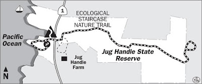 |
Map from the California State Parks site--note the lack of detail
|
Directions
Three miles south of Fort Bragg, the trail begins off Highway 1 and loops around bluffs overlooking a beach; numbered markers (there was a brochure somewhere with explanations) let you know that you are going the right way. The trail then leads you under a Highway 1 bridge/overpass and brings you to a well-kept trail where the numbered markers continue through a breathtaking forest. Elevation gain is a minimal 300 feet, but at points, the trail does have staircases and areas of gentle elevation gain. At the end of the trail is a
pygmy forest, a whimsical-like forest comprised of short-stature plants and trees caused by nutrient-poor, alkaline soil--the forest is one of a handful in the world.
At the trail's end, we decided to take the Gibney Fire Road shortcut suggested on the state parks site. The result was that we almost got lost if not for a kind local woman (thank you!) who was walking with her children on the road behind us and called out to us to ask if we were looking for the trail back to the beach. Thanks to her instructions, we successfully rejoined the trail.
Shortcut from Gibney Fire Road
 |
| Pygmy Forest walkway |
When you reach the outskirts of the pygmy forest (characterized by sandy soil), you will see a straight road that intersects the trail--it goes in a westerly direction to your left--which is the Gibney Fire Road. Walk past the vertical markers that separate the pygmy forest from the fire road, and you will soon arrive at the pygmy forest walkway. Follow this loop-around walkway, and you arrive back at the same point, except this time the Gibney Fire Road is now ahead of you. Heading west/straight, we followed the dirt Gibney Fire Road, which ends at an open gate with a private property sign facing the direction in which we were walking. (FYI: This is the point where we got lost.) The road beyond the private property gate is a paved two-lane residential road with no obvious Jug Handle SNR signs.
Directions
From the Gibney Fire Road, walk by a few houses on the left. You will then see a road immediately to the left that is marked "Private Road." Walk just beyond this road, and you will see a small cut-out trail off to the left in a thicket of trees. This is the Jug Handle trail.
To rejoin the trail, walk past a narrow wooden trail post with a small square or rectangular-shaped yellow marker on it. (You will see that this span of trail is not as well kept as the rest of the Jug Handle trail.) Turn right at the first fork in the road, and then later on make a left.
 |
| Gibney Fire Road |
You will know that you are on the right path back to your car when you see a #21 numbered marker within five minutes; the numbers get smaller as you continue your trek. The trail scenery should be familiar as you retrace your steps, such as:
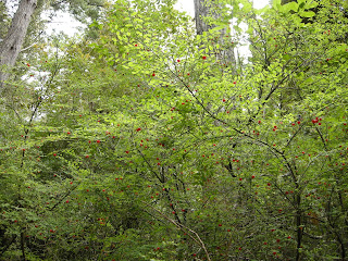 |
| A tall, delicate-looking plant with tiny, bright-red berries |
 |
| Short staircase |
 |
| Long Staircase |
I hope that this helps those who have gotten lost, such as we have.


